Scientific Illustrations · earth-science
Earth Layers Diagram — AI Generator
Create accurate Earth layers diagrams with AI. Shows crust, mantle, outer core, inner core with depth, temperature, and composition.
Prompt
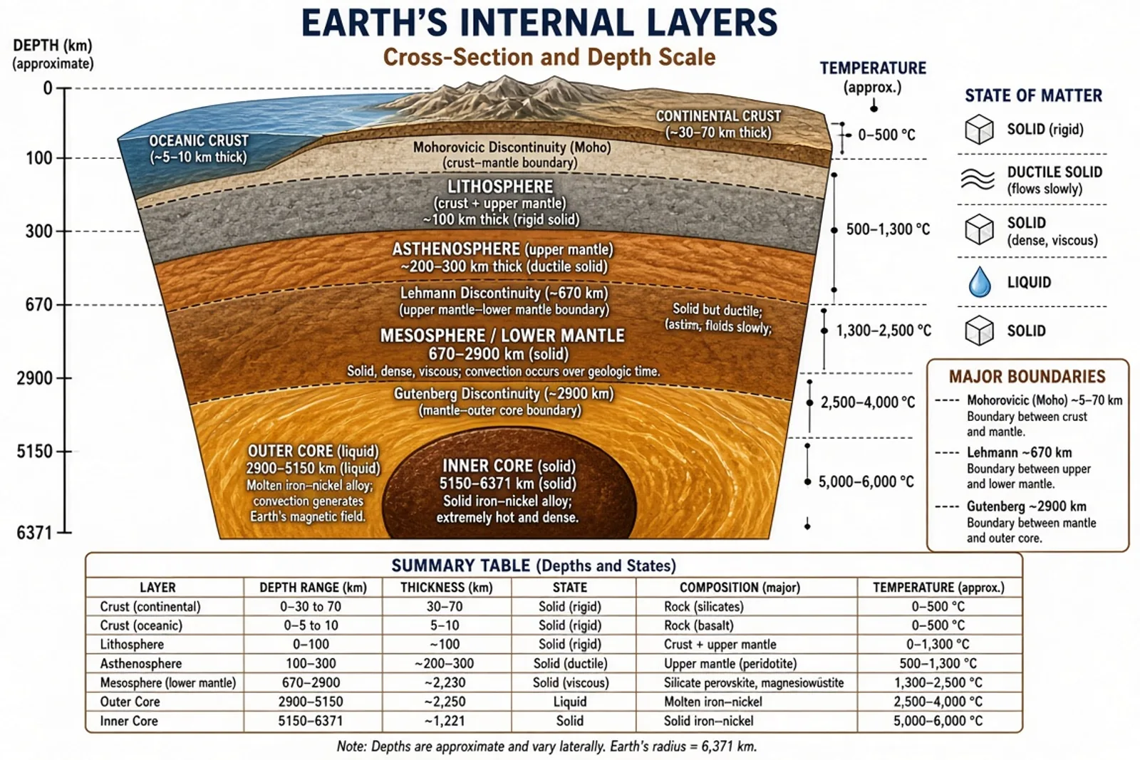
Accurate labeled cross-section diagram of Earth's internal layers. Show: Crust (continental and oceanic labeled, 5-70km), Lithosphere (crust + upper mantle, 100km), Asthenosphere (upper mantle, 200-300km), Mesosphere/lower mantle (670-2900km), Outer core (liquid, 2900-5150km), Inner core (solid, 5150-6371km). Include depth scale in km, temperature indicators, state of matter labels (solid/liquid), and major boundaries (Mohorovicic, Gutenberg, Lehmann). Earth-tone color scheme, white background.
Scientific illustration resources
Prompt the subject, then verify the science
Use the matching prompt guide to refine this draft. Before publishing, check every label, structure and relationship against an authoritative source or a qualified subject expert.
Related images
More earth-science entries from the same generator
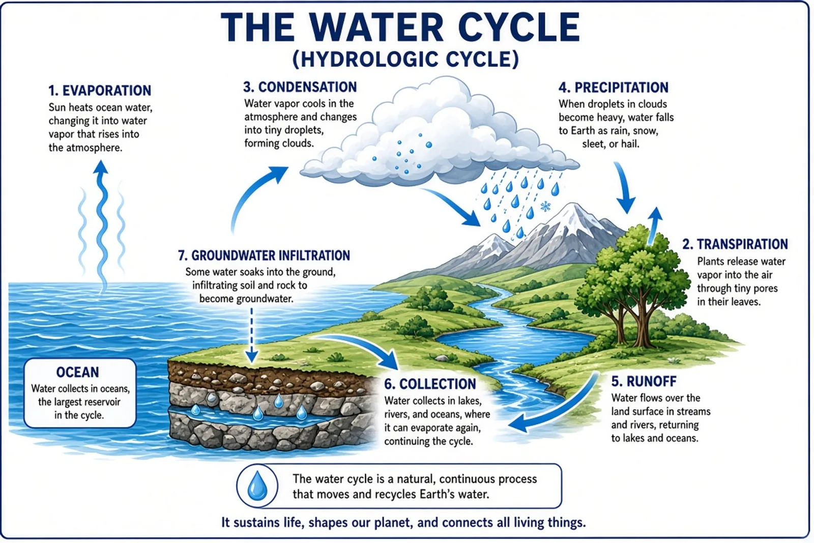 Water Cycle Diagram — AI GeneratorView · earth-science
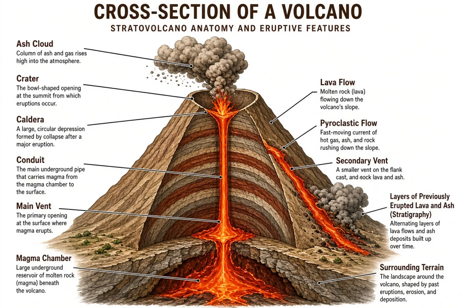 Volcano Diagram — AI GeneratorView · earth-science
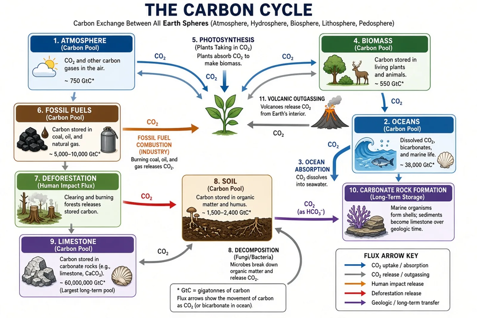 Carbon Cycle Diagram — AI GeneratorView · earth-science
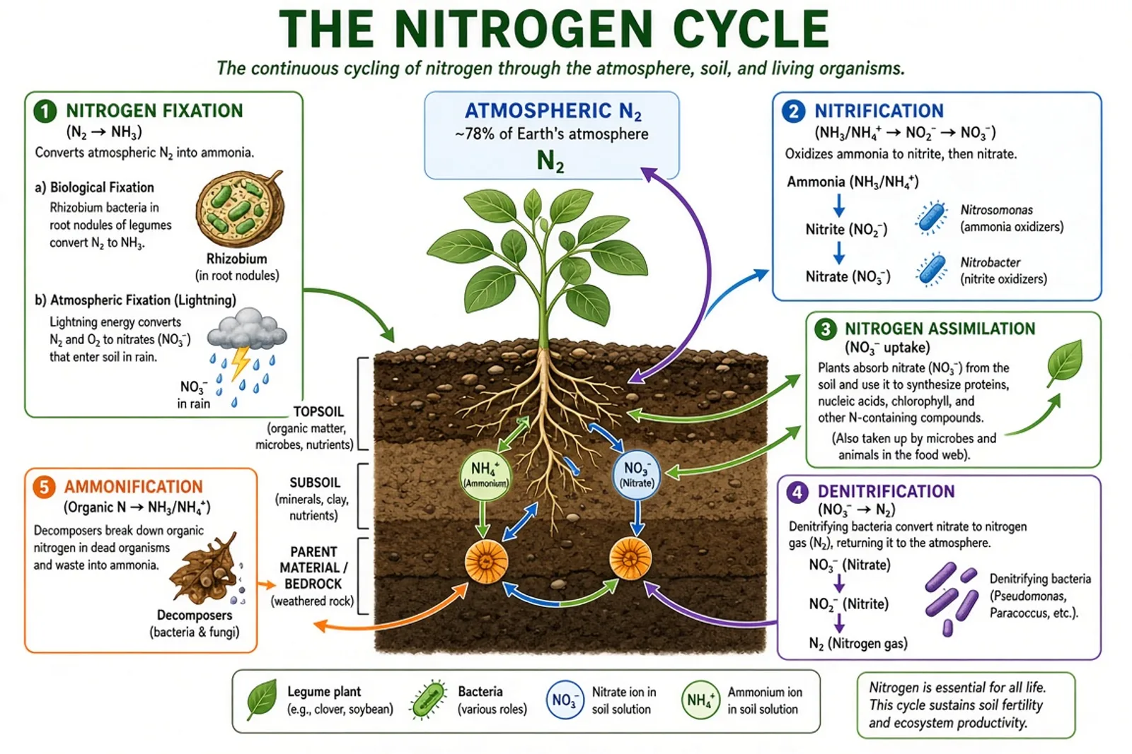 Nitrogen Cycle Diagram — AI GeneratorView · earth-science
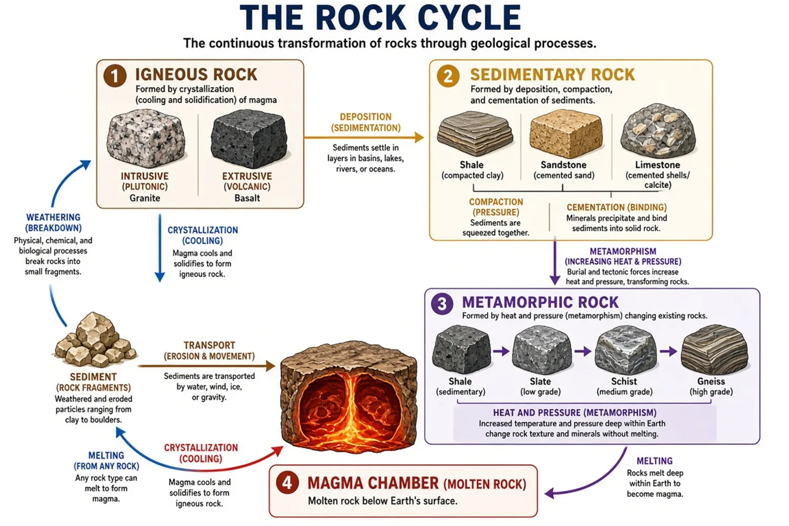 Rock Cycle Diagram — AI GeneratorView · earth-science
Frequently asked questions
What layers are shown?
All major layers: Crust (continental and oceanic), Lithosphere, Asthenosphere, Mesosphere (lower mantle), Outer Core (liquid iron-nickel), and Inner Core (solid iron-nickel).
Are depth and temperature included?
Yes. Depth scale in kilometers and approximate temperatures are shown at each layer boundary.